Torcastle: Medieval Highland castle once again accessible
Banquo’s Walk, a wide, tree-lined avenue with parallel banks, has long been believed to have been formed as a ceremonial route associated with folklore attached to the nearby ruins of Tor-castle. However, the 8m wide route, which ended abruptly at both ends, was located in line with no known sites or features. Combined with its extreme width and low-lying surface, the assumption of it’s construction as a road was brought into question.
The route of Banquo’s Walk has evoked much legend and intrigue over time in association with the castle at Torcastle and the tenuous links of Clan Cameron to Banquo. In order to learn more about the construction and potential use of the site, a survey and archaeological evaluation was undertaken in November 2016 by Lochaber Archaeological Society and AOC Archaeology, revealing indeed that there was no road surface present within the well built banks defining “Banquo’s Walk”.
Evaluation of the soil strata, which contained a thick natural layer of clay, revealed that the best possible explanation for it’s construction was for use in clay extraction. The fieldwork has dispelled 150 years of myth attached to the site.
Overall, Banquo’s Walk measures between 8 – 8.5m wide between banks built along the northwest and southeast sides. It is covered in a thick bed of moss under spreads of leaf litter and fallen tree trunks and branches. The banks measure between 0.6-0.7m wide and 0.6-1.0m high, with a steepsided inner face and a more gently sloping outer face running to a ground level 0.3-0.5m higher than the interior surface (Figure 6). There is considerable variation along the route alignment. In lengthy sections of the route on the inside of the banks, there appears to be ditched sections up to 1m wide. These potential features are visible on varying sides of the road, often on both sides at the same time, and occasionally on neither side. In places, the central surface has a visibly rounded camber, while in others it sits lower than the sides and is in a water-logged condition. In some areas, there are mounds of soil and patches of shrubbery. While mapping shows the route running for a distance of around 415m, visibly it runs for about 300m where the built banks defining the wide surface are seen. At the southwest end, the route runs downhill gently and there is no continuation of the banks or lowered central surface to distinguish its presence. At the northeast end, the route ends abruptly at a steep, but small, burn valley where natural rock outcrop is exposed. Woodland mostly surrounds the route, although the occasional mature tree is present, particularly at the northeast end where the route diverges around a small tree group.
The aim of the fieldwork was to provide information about the construction of Banquo’s Walk, which was believed to have formed an old road or ceremonial route. The initial survey of the route of Banquo’s Walk had posed several questions:
1) Why was the road built so widely, 3-4 times wider than most early military roads?
2) Why were there banks built up on both sides?
3) Why was the interior surface built substantially lower than the exterior?
4) Why is there only one random section of this wide, bank-lined section?
5) Why does it end abruptly on both ends at no particular site/location?
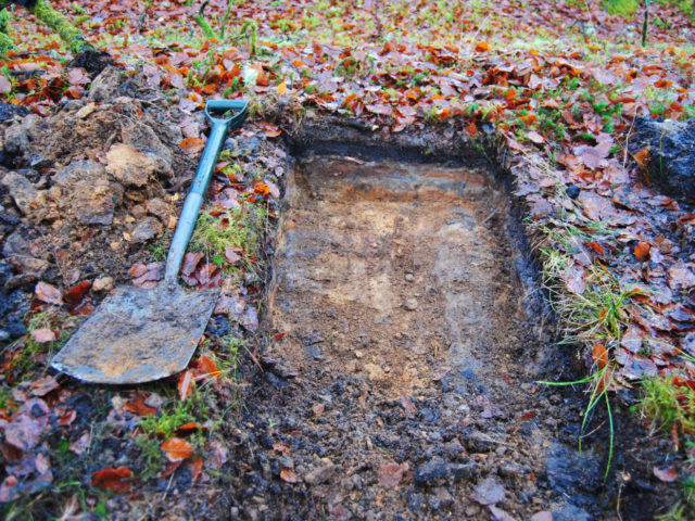
The evaluation showed that a road surface was not present along Banquo’s Walk. Trench 1, Trench 2 and Test Pit 4 revealed an undulating clay layer with no evidence for surfacing with gravel or stonework. The interior sat 0.3 to 0.5m lower than the exterior ground layer. The section of the northwest bank in Trench 3 revealed that the banks had been built using redeposited layers of subsoil and clay, with a thin soil layer over a clay band. The exterior test pit revealed the natural stratigraphy of a soil layer over a thick band of clay over the subsoil. This mirrored the layers at the base of the bank in Trench 3 – suggesting that this section of the bank had been built over an earlier old ground surface, which sat on natural clay.
These results indicated that the interior of Banquo’s Walk had been formed by the removal of natural layers, creating a lower level. The lack of compact deposits on and the undulating condition of the interior surface, with discontinuous ditch-like dips, indicates that there had been no construction of a road surface. Rather, the supposed road surface was formed by digging out the natural material. The removed material was utilised and was used to construct the banks built alongside the dug-out area. The built banks delineated the area where layers had been dug out.


